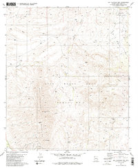
1981 Map of San Cayetano Mts.
USGS Topo · Published 1985About this map
The Luis Maria Baca Float No 3 boundary dominates the central landscape of this Santa Cruz County territory, reflecting a complex history of Spanish land grants and grazing rights. The rugged slopes of the San Cayetano Mountains rise sharply in the west, punctuated by San Cayetano Peak and Mt Shibell. Resource extraction and ranching define the human imprint on the land, evidenced by the Salero Ranch and the Tubutama Mine nestled within the ridges. Water sources are critical in this arid environment, with reliable points like Tejano Spring, Coal Mine Spring, and Chivas Tank scattered along the drainages of Josephine Canyon and Alamo Canyon. To the northeast, the map transitions into the Coronado National Forest, where a small Cem and Radio Facility stand near the edge of the Grant Boundary.
Find a feature on this map
28 named features on this map. Tap any name to fly to it.
Don’t see what you’re looking for? This feature index may not catch every label — zoom into the map to look around manually.
Map Details
Editions of this 1981 San Cayetano Mts. Map
3 editions found
Other maps of this area

1904 · Patagonia
USGS Topo · 1:125,000

1905 · Patagonia
USGS Topo · 1:125,000

1905 · Nogales
USGS Topo · 1:125,000

1920 · Arivaca
USGS Topo · 1:125,000

1921 · Old Glory
USGS Topo · 1:125,000

1922 · Agus Caliente
USGS Topo · 1:62,500

1933 · Calabasas
USGS Topo · 1:62,500

1939 · Tubac
USGS Topo · 1:62,500

1942 · Ruby
USGS Topo · 1:62,500

1943 · Old Glory
USGS Topo · 1:125,000