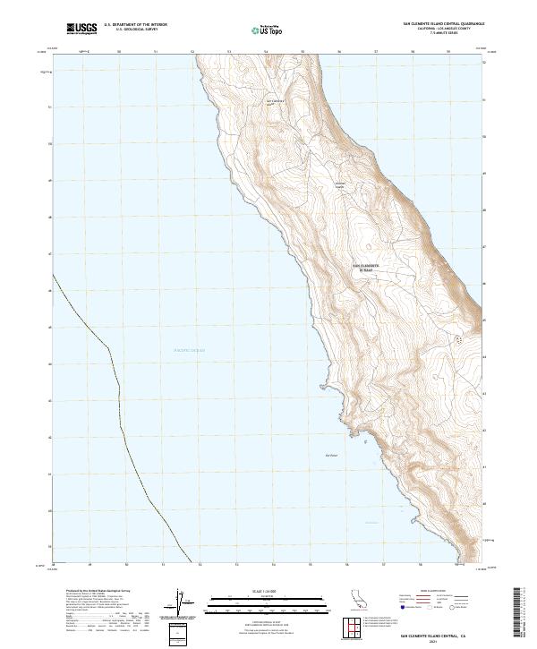
2021 Map of San Clemente Island Central
USGS Topo · Published 2021About this map
San Clemente Island rises from the Pacific Ocean in this coastal survey, capturing the rugged interior and shoreline of the central portion of this southernmost member of the Channel Islands. The topography is defined by sharp contour intervals that illustrate the island's steep maritime terraces and drainage ravines, highlighting natural coastal landmarks such as Eel Point on the western shore. Farther south, the indentation of Seal Cove breaks the coastline, providing a notable geographic reference for maritime history and environmental study within the Los Angeles County jurisdiction. Because the island is a restricted government reservation, this modern topographic record provides one of the few detailed visual accounts of the landforms and undeveloped coastal reaches as they remained in the early twenty-first century.
Find a feature on this map
5 named features on this map. Tap any name to fly to it.
Don’t see what you’re looking for? This feature index may not catch every label — zoom into the map to look around manually.
Map Details
Editions of this 2021 San Clemente Island Central Map
This is the sole edition of this map. No revisions or reprints were ever made.
Other maps of this area
1943 · San Clemente Island North
USGS Topo · 1:24,000

1943 · San Clemente Island Central
USGS Topo · 1:24,000

1949 · Long Beach
USGS Topo · 1:250,000
1950 · San Clemente Island North
USGS Topo · 1:24,000

1950 · San Clemente Island Central
USGS Topo · 1:24,000

1957 · Long Beach
USGS Topo · 1:250,000

1957 · San Clemente Island
USGS Topo · 1:250,000

1958 · Long Beach
USGS Topo · 1:250,000

1960 · Long Beach
USGS Topo · 1:250,000

1980 · San Clemente Island
USGS Topo · 1:100,000