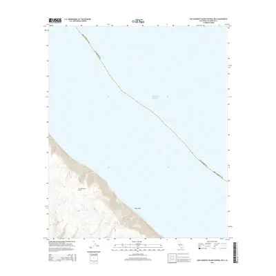
2015 Map of San Clemente Island Central OE E
USGS Topo · Published 2015About this map
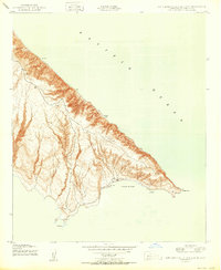
San Clemente Island rises steeply from the Pacific Ocean in this 2015 topographic study of the island's central coastline. The map focuses on the dramatic transition from the high interior terrain to the sea, where steep slopes and deeply incised canyons drop toward the water. A prominent coastal feature, White Rock, sits at the base of these cliffs, marking a distinct point along the shoreline. The island's isolation within Los Angeles County is underscored by the absence of roads or permanent settlements on this portion of the landmass, which is instead defined by its complex elevation contours and maritime boundary.
Find a feature on this map
5 named features on this map. Tap any name to fly to it.
Don’t see what you’re looking for? This feature index may not catch every label — zoom into the map to look around manually.
Map Details
Editions of this 2015 San Clemente Island Central OE E Map
This is the sole edition of this map. No revisions or reprints were ever made.
Other maps of this area
1943 · San Clemente Island North
USGS Topo · 1:24,000
1943 · San Clemente Island South
USGS Topo · 1:24,000

1943 · San Clemente Island Central
USGS Topo · 1:24,000

1949 · Long Beach
USGS Topo · 1:250,000
1950 · San Clemente Island North
USGS Topo · 1:24,000

1950 · San Clemente Island Central
USGS Topo · 1:24,000
1950 · San Clemente Island South
USGS Topo · 1:24,000

1957 · Long Beach
USGS Topo · 1:250,000

1957 · San Clemente Island
USGS Topo · 1:250,000

1958 · Long Beach
USGS Topo · 1:250,000