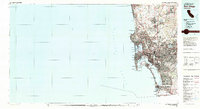
1979 Map of San Diego
USGS Topo · Published 1980About this map
San Diego and its surrounding coastal communities are captured here in a period of significant late-century development, framed by a heavy military presence and an intricate network of naval installations. From the Miramar Naval Air Station to the San Diego Naval Station, the landscape reflects the city's strategic importance. The interface between the city and the Pacific Ocean is defined by landmarks like Silver Strand, North Island, and the protected waters of Mission Bay.
Find a feature on this map
78 named features on this map. Tap any name to fly to it.
Don’t see what you’re looking for? This feature index may not catch every label — zoom into the map to look around manually.
Map Details
Editions of this 1979 San Diego Map
3 editions found
Other maps of this area

1893 · El Cajon
USGS Topo · 1:62,500

1893 · Oceanside
USGS Topo · 1:62,500

1893 · Escondido
USGS Topo · 1:62,500

1898 · Oceanside
USGS Topo · 1:62,500

1901 · Elcajon
USGS Topo · 1:62,500

1901 · Escondido
USGS Topo · 1:62,500

1901 · Oceanside
USGS Topo · 1:62,500

1901 · San Luis Rey
USGS Topo · 1:125,000

1902 · Capistrano
USGS Topo · 1:125,000

1903 · Cuyamaca
USGS Topo · 1:125,000