1979 Map of San Diego
USGS Topo · Published 1988About this map
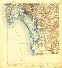
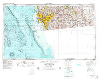
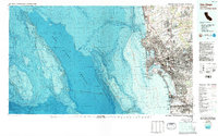
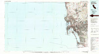
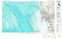
San Diego and the international border zone are captured in this topographic-bathymetric study, which reveals the complex relationship between the coastal shelf and the deep waters of the Pacific Ocean. This map illustrates a region defined by heavy military presence and significant urban development, featuring expansive installations like Miramar Naval Air Station and Fort Rosecrans Military Res alongside civilian centers like Chula Vista and La Jolla. The detailed bathymetry highlights the submarine landscape of the La Jolla Canyon and the steep Coronado Escarpment, providing a rare look at the underwater geography that mirrors the coastal mesas. South of the border, the urban grid of Tijuana and Playas de Tijuana shows the contiguous growth across the boundary near Border Field State Park. Landmarks such as the Silver Strand and North Island demonstrate the modification of the harbor for maritime and naval operations.
Find a feature on this map
63 named features on this map. Tap any name to fly to it.
Don’t see what you’re looking for? This feature index may not catch every label — zoom into the map to look around manually.
Map Details
Editions of this 1979 San Diego Map
3 editions found
Historical Maps of El Cajon Through Time
7 maps found