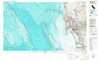
1979 Map of San Diego
USGS Topo · Published 1988About this map
The San Diego waterfront and its complex underwater topography are the focus of this late-1970s topographic-bathymetric survey. From the urban density of National City and Chula Vista to the international border at Tijuana, the map captures a period of significant coastal development and military importance. Large federal footprints are evident at Miramar Naval Air Station and the various naval installations flanking San Diego Bay. This edition is particularly distinctive for its detailed submarine contours, which reveal the steep drop-offs of La Jolla Canyon and the massive Coronado Escarpment rising from the San Diego Trough. Along the shoreline, established recreation areas like Mission Bay Park and Silver Strand State Beach appear alongside academic landmarks including the Scripps Institution of Oceanography, illustrating the region's mid-century transition into a hub for maritime research and tourism.
Find a feature on this map
69 named features on this map. Tap any name to fly to it.
Don’t see what you’re looking for? This feature index may not catch every label — zoom into the map to look around manually.
Map Details
Editions of this 1979 San Diego Map
3 editions found
Other maps of this area

1893 · El Cajon
USGS Topo · 1:62,500

1893 · Oceanside
USGS Topo · 1:62,500

1893 · Escondido
USGS Topo · 1:62,500

1898 · Oceanside
USGS Topo · 1:62,500

1901 · Elcajon
USGS Topo · 1:62,500

1901 · Escondido
USGS Topo · 1:62,500

1901 · Oceanside
USGS Topo · 1:62,500

1901 · San Luis Rey
USGS Topo · 1:125,000

1902 · Capistrano
USGS Topo · 1:125,000

1903 · Cuyamaca
USGS Topo · 1:125,000