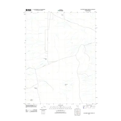
2011 Map of San Emidio Desert North
USGS Topo · Published 2011About this map
The San Emidio Desert landscape of northern Nevada reveals a region shaped by ephemeral watercourses and remote ranching infrastructure. Arid drainage patterns are defined by several seasonal flows including Willow Creek, Coyote Creek, and Bull Creek, while more significant topographical shifts appear in the southwest corner through Rattlesnake Canyon and Little Rattlesnake Canyon. A distinctive man-made feature of this landscape is the Empire Farms Landing Strip, which sits at the junction of several local routes like Farm District Rd and Echo Canyon Rd. This road network suggests a sparse, large-scale agricultural or ranching presence, where accessibility depends on long stretches of desert track. The presence of Jackass Spring further indicates the vital importance of natural water sources for both livestock and early travelers navigating the rugged northern reaches of Washoe County.
Find a feature on this map
14 named features on this map. Tap any name to fly to it.
Don’t see what you’re looking for? This feature index may not catch every label — zoom into the map to look around manually.
Map Details
Editions of this 2011 San Emidio Desert North Map
This is the sole edition of this map. No revisions or reprints were ever made.
Other maps of this area

1886 · Granite Range
USGS Topo · 1:250,000

1894 · Granite Range
USGS Topo · 1:250,000

1955 · Lovelock
USGS Topo · 1:250,000

1959 · Lovelock
USGS Topo · 1:250,000

1964 · Gerlach
USGS Topo · 1:62,500

1964 · Kumiva Peak
USGS Topo · 1:62,500

1965 · Fox Range
USGS Topo · 1:62,500

1980 · Smith Canyon
USGS Topo · 1:24,000

1981 · Gerlach
USGS Topo · 1:100,000
1984 · Kumiva Peak
USGS Topo · 1:100,000