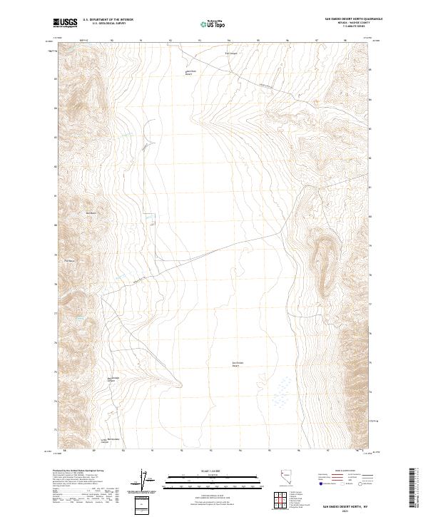
2021 Map of San Emidio Desert North
USGS Topo · Published 2021About this map
The San Emidio Desert and the southwestern edge of the Black Rock Desert dominate this remote Washoe County landscape. This modern survey illustrates a rugged expanse where water is the primary architect of the geography, evidenced by intermittent drainages like Willow Creek, Coyote Creek, and Rodeo Creek that spill from the higher elevations of the Fox Range. The presence of Jackass Spring near the mouth of a western canyon highlights a rare permanent water source in this arid environment, a feature historically critical for both wildlife and early travelers.
Find a feature on this map
18 named features on this map. Tap any name to fly to it.
Don’t see what you’re looking for? This feature index may not catch every label — zoom into the map to look around manually.
Map Details
Editions of this 2021 San Emidio Desert North Map
This is the sole edition of this map. No revisions or reprints were ever made.
Other maps of this area

1886 · Granite Range
USGS Topo · 1:250,000

1894 · Granite Range
USGS Topo · 1:250,000

1955 · Lovelock
USGS Topo · 1:250,000

1959 · Lovelock
USGS Topo · 1:250,000

1964 · Gerlach
USGS Topo · 1:62,500

1964 · Kumiva Peak
USGS Topo · 1:62,500

1965 · Fox Range
USGS Topo · 1:62,500

1980 · Smith Canyon
USGS Topo · 1:24,000

1981 · Gerlach
USGS Topo · 1:100,000
1984 · Kumiva Peak
USGS Topo · 1:100,000