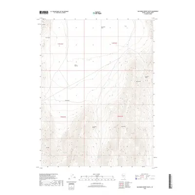
2018 Map of San Emidio Desert South
USGS Topo · Published 2018About this map
The San Emidio Desert provides the central focal point for this 2018 study of the high-altitude basin and range topography in Washoe County. The terrain transitions from the open expanse of White Sage Flat into the steep rises of the Fox Range to the northwest and the Lake Range to the southeast. These mountains are punctuated by prominent elevations such as Wildcat Peak and Kits Peak, with deep drainage features including Stag Canyon and San Emidio Canyon carving through the slopes.
Find a feature on this map
17 named features on this map. Tap any name to fly to it.
Don’t see what you’re looking for? This feature index may not catch every label — zoom into the map to look around manually.
Map Details
Editions of this 2018 San Emidio Desert South Map
This is the sole edition of this map. No revisions or reprints were ever made.
Other maps of this area

1886 · Granite Range
USGS Topo · 1:250,000

1894 · Granite Range
USGS Topo · 1:250,000

1955 · Lovelock
USGS Topo · 1:250,000

1959 · Lovelock
USGS Topo · 1:250,000
1964 · Tohakum Peak NE
USGS Topo · 1:24,000

1964 · Tohakum Peak NW
USGS Topo · 1:24,000

1964 · Kumiva Peak
USGS Topo · 1:62,500

1964 · Pyramid NE
USGS Topo · 1:24,000

1965 · Fox Range
USGS Topo · 1:62,500
1984 · Kumiva Peak
USGS Topo · 1:100,000