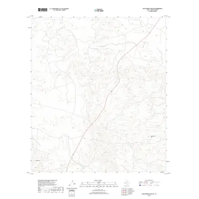
2019 Map of San Esteban Lake SW
USGS Topo · Published 2019About this map
Frenchman Hills and the Black Hills define this high-desert region of Presidio County, where ephemeral watercourses have carved a complex network of drainage basins. The landscape is dominated by the winding paths of Perdiz Creek and Cienega Creek, which reveal the erosional patterns of the Trans-Pecos. A primary artery, Highway 67, bisects the terrain, providing the only major transit corridor through these elevated rangelands. The proximity of several smaller tributaries, such as Matonoso Cr and Dunman Cr, illustrates the hydrological dependency of the area’s remote ranching history. This 2019 survey documents the modern topographic state of these western Texas uplands, emphasizing the stark relationship between the high peaks and the dry creek beds that define the local geography.
Find a feature on this map
9 named features on this map. Tap any name to fly to it.
Don’t see what you’re looking for? This feature index may not catch every label — zoom into the map to look around manually.
Map Details
Editions of this 2019 San Esteban Lake SW Map
This is the sole edition of this map. No revisions or reprints were ever made.
Other maps of this area

1895 · Marfa
USGS Topo · 1:125,000

1896 · Shafter
USGS Topo · 1:125,000

1959 · Presidio
USGS Topo · 1:250,000

1959 · Marfa
USGS Topo · 1:250,000

1965 · Presidio
USGS Topo · 1:250,000

1965 · Marfa
USGS Topo · 1:250,000
1983 · San Esteban Lake
USGS Topo · 1:24,000

1983 · Cuesta Del Burro East
USGS Topo · 1:24,000
1983 · Frenchman Hills
USGS Topo · 1:24,000
1983 · Cerros Prietos
USGS Topo · 1:24,000