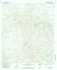
1983 Map of San Esteban Lake SW
USGS Topo · Published 1983About this map
Stage Stand Windmill and numerous other remote water points define this arid reach of Presidio County in the early 1980s. The landscape is carved by seasonal drainages such as Perdiz Creek and Shannon Draw, which give way to more complex networks like Ranger Camp Creek and Cienega Creek in the south. This era reflects a ranching infrastructure reliant on dispersed wells and windmills, including Cow Heaven Windmill and Bebecita Windmill, often connected only by a rugged Jeep Trail. A long-distance highway corridor bisects the terrain, marked by a lone Roadside Park. Near the southern edge, localized aviation and stock management are evidenced by the presence of Landing Strips and the Mud Tank reservoir. The drainage patterns of Dunman Creek and Matonoso Creek illustrate the watershed's descent toward the Rio Grande valley further south.
Find a feature on this map
16 named features on this map. Tap any name to fly to it.
Don’t see what you’re looking for? This feature index may not catch every label — zoom into the map to look around manually.
Map Details
Editions of this 1983 San Esteban Lake SW Map
This is the sole edition of this map. No revisions or reprints were ever made.
Other maps of this area

1895 · Marfa
USGS Topo · 1:125,000

1896 · Shafter
USGS Topo · 1:125,000

1959 · Presidio
USGS Topo · 1:250,000

1959 · Marfa
USGS Topo · 1:250,000

1965 · Presidio
USGS Topo · 1:250,000

1965 · Marfa
USGS Topo · 1:250,000
1983 · San Esteban Lake
USGS Topo · 1:24,000

1983 · Cuesta Del Burro East
USGS Topo · 1:24,000
1983 · Frenchman Hills
USGS Topo · 1:24,000
1983 · Cerros Prietos
USGS Topo · 1:24,000