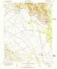
1955 Map of San Felipe
USGS Topo · Published 1956About this map
San Felipe Lake and the winding Tequisquita Slough dominate this mid-century view of the agricultural corridor between the Santa Clara and San Benito county lines. The landscape is defined by broad ranching and farming tracts like the Bolsa de San Felipe and Llano de Laguna de las Muertas, intersected by a network of named country lanes and irrigation canals. The settlement pattern reveals the local importance of education and small hubs, with Pacheco Sch, Ausaymas Sch, and Fairhaven Sch serving the surrounding rural population.
Find a feature on this map
51 named features on this map. Tap any name to fly to it.
Don’t see what you’re looking for? This feature index may not catch every label — zoom into the map to look around manually.
Map Details
Editions of this 1955 San Felipe Map
4 editions found
Other maps of this area

1915 · San Juan Bautista
USGS Topo · 1:48,000

1917 · Morgan Hill
USGS Topo · 1:62,500

1917 · San Juan Bautista
USGS Topo · 1:62,500

1919 · Hollister
USGS Topo · 1:48,000

1921 · Gilroy Hot Springs
USGS Topo · 1:62,500

1921 · Hollister
USGS Topo · 1:62,500

1923 · Hollister
USGS Topo · 1:62,500

1939 · Morgan Hill
USGS Topo · 1:62,500

1939 · Gilroy Hot Springs
USGS Topo · 1:62,500

1939 · San Juan Bautista
USGS Topo · 1:62,500