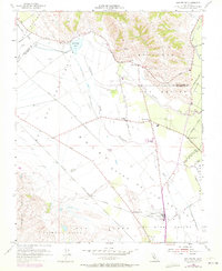
1955 Map of San Felipe
USGS Topo · Published 1972About this map
San Felipe Lake and the drainage of Tequisquita Slough anchor this landscape along the border of Santa Clara and San Benito counties. The terrain transitions from the low-lying Llano Del Tequisquita to the rising San Felipe and Ausaymas hills. A network of rural roads such as Lovers Lane and Shore Road connect small agricultural settlements and rural schoolhouses including Pacheco Sch and Ausaymas Sch.
Find a feature on this map
45 named features on this map. Tap any name to fly to it.
Don’t see what you’re looking for? This feature index may not catch every label — zoom into the map to look around manually.
Map Details
Editions of this 1955 San Felipe Map
4 editions found
Other maps of this area

1915 · San Juan Bautista
USGS Topo · 1:48,000

1917 · Morgan Hill
USGS Topo · 1:62,500

1917 · San Juan Bautista
USGS Topo · 1:62,500

1919 · Hollister
USGS Topo · 1:48,000

1921 · Gilroy Hot Springs
USGS Topo · 1:62,500

1921 · Hollister
USGS Topo · 1:62,500

1923 · Hollister
USGS Topo · 1:62,500

1939 · Morgan Hill
USGS Topo · 1:62,500

1939 · Gilroy Hot Springs
USGS Topo · 1:62,500

1939 · San Juan Bautista
USGS Topo · 1:62,500