
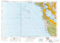
1956 Map of San Francisco
USGS Topo · Published 1956About this map
The San Francisco peninsula and the surrounding Bay Area appear in high detail during the late mid-century, showcasing a landscape defined by intensive coastal development and massive military infrastructure. Major naval and army installations like Hunters Point Naval Shipyard, Alameda NAS, and the Presidio Mil Res anchor the mouth of the bay, while the Golden Gate Bridge and San Francisco-Oakland Bay Bridge facilitate the expanding suburban reach into San Mateo and Alameda County.
Find a feature on this map
164 named features on this map. Tap any name to fly to it.
Don’t see what you’re looking for? This feature index may not catch every label — zoom into the map to look around manually.
Map Details
Editions of this 1956 San Francisco Map
4 editions found
Other maps of this area

1889 · San Jose
USGS Topo · 1:62,500

1892 · San Mateo
USGS Topo · 1:62,500

1895 · San Francisco
USGS Topo · 1:62,500

1896 · San Mateo
USGS Topo · 1:62,500

1896 · Carquinez Strait
USGS Topo · 1:62,500

1896 · Mt. Diablo
USGS Topo · 1:62,500

1897 · San Jose
USGS Topo · 1:62,500

1897 · Concord
USGS Topo · 1:62,500

1897 · Palo Alto
USGS Topo · 1:62,500

1897 · Tamalpais
USGS Topo · 1:62,500