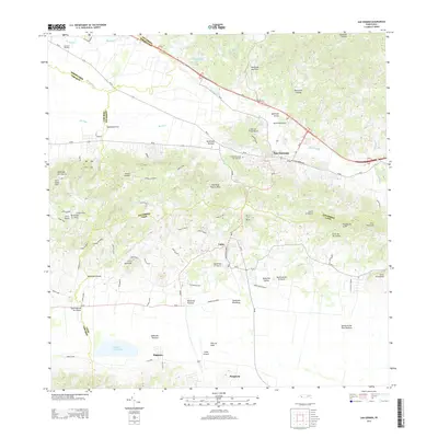
2013 Map of San German
USGS Topo · Published 2013About this map
The historic town of San Germán serves as a centerpiece for this region of southwest Puerto Rico, situated where the northern foothills meet the expansive Valle de Lajas. In the early 21st century, the landscape reflects a blend of dense urban settlement and significant agricultural tradition, notably at Central Eureka near the northern boundary. The terrain transitions from the coastal lowlands near Laguna Cartagena and the southern settlement of Parguera up into the prominent heights of Monte Grande and Cerro Quemado. Waterways such as the Río Guanajibo and Río Viejo define the drainage patterns of the valley, while the presence of Lajas Airpark and the Cementerio de San Germán provides specific landmarks for local history research. The detailed mapping of the numerous quebradas, including Quebrada de los Llanos and Quebrada Mamey, illustrates the complex hydrology of this varied topography.
Find a feature on this map
62 named features on this map. Tap any name to fly to it.
Don’t see what you’re looking for? This feature index may not catch every label — zoom into the map to look around manually.
Map Details
Editions of this 2013 San German Map
This is the sole edition of this map. No revisions or reprints were ever made.
Other maps of this area

1935 · Puerto Real
USGS Topo · 1:25,000

1937 · San German
USGS Topo · 1:25,000

1937 · Sabana Grande
USGS Topo · 1:25,000

1937 · Puerto Real
USGS Topo · 1:25,000

1938 · Guanica
USGS Topo · 1:30,000

1938 · Parguera
USGS Topo · 1:30,000

1938 · Cabo Rojo
USGS Topo · 1:30,000

1939 · Mayaguez
USGS Topo · 1:30,000

1941 · San German
USGS Topo · 1:30,000

1941 · Puerto Real
USGS Topo · 1:30,000