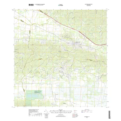
2018 Map of San German
USGS Topo · Published 2018About this map
San Germán and Lajas anchor this southwestern Puerto Rican landscape, where the urban centers of the interior meet the agricultural expanse of the Valle de Lajas. The terrain transitions from the northern ridges of the Cordillera Central foothills down to the coastal plains, defined by the prominent Sierra Bermeja and peaks like Picacho de la Tea. In the south, the Laguna Cartagena National Wildlife Refuge preserves a significant freshwater wetland system, a contrast to the engineered Canal Principal De Riego Valle De Lajas which supports the local sugar and cattle history of the valley. Local infrastructure includes the Lajas Airpark and major thoroughfares like PR-2, while historic sites such as the Cementerio de San Germán provide points of interest for genealogists and local historians tracing the development of one of the island's oldest settlements.
Find a feature on this map
54 named features on this map. Tap any name to fly to it.
Don’t see what you’re looking for? This feature index may not catch every label — zoom into the map to look around manually.
Map Details
Editions of this 2018 San German Map
This is the sole edition of this map. No revisions or reprints were ever made.
Other maps of this area

1935 · Puerto Real
USGS Topo · 1:25,000

1937 · San German
USGS Topo · 1:25,000

1937 · Sabana Grande
USGS Topo · 1:25,000

1937 · Puerto Real
USGS Topo · 1:25,000

1938 · Guanica
USGS Topo · 1:30,000

1938 · Parguera
USGS Topo · 1:30,000

1938 · Cabo Rojo
USGS Topo · 1:30,000

1939 · Mayaguez
USGS Topo · 1:30,000

1941 · San German
USGS Topo · 1:30,000

1941 · Puerto Real
USGS Topo · 1:30,000