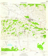
1957 Map of San German
USGS Topo · Published 1959About this map
San Germán serves as the historic center of this southwestern Puerto Rican landscape, divided here into Pueblo Occidental and Pueblo Central. The 1957 revision captures a period of transition, where the Via Ferrocarril and Antigua Via Ferrocarril trace the movement of sugar and goods between the Central Eureka mill and the various haciendas. This agrarian economy is further evidenced by a complex irrigation network, including the Canal Principal de Riego and numerous siphons, which feed the fertile lowlands of Sabana Grande Abajo and Llanos. To the south, the Laguna Cartagena dominates the coastal plain, while institutional landmarks like the Instituto Politécnico and the Universidad de Puerto Rico Estación Experimental signify the region's growing educational and scientific importance during the mid-20th century.
Find a feature on this map
98 named features on this map. Tap any name to fly to it.
Don’t see what you’re looking for? This feature index may not catch every label — zoom into the map to look around manually.
Map Details
Editions of this 1957 San German Map
This is the sole edition of this map. No revisions or reprints were ever made.
Other maps of this area

1935 · Puerto Real
USGS Topo · 1:25,000

1937 · San German
USGS Topo · 1:25,000

1937 · Sabana Grande
USGS Topo · 1:25,000

1937 · Puerto Real
USGS Topo · 1:25,000

1938 · Guanica
USGS Topo · 1:30,000

1938 · Parguera
USGS Topo · 1:30,000

1938 · Cabo Rojo
USGS Topo · 1:30,000

1939 · Mayaguez
USGS Topo · 1:30,000

1941 · San German
USGS Topo · 1:30,000

1941 · Puerto Real
USGS Topo · 1:30,000