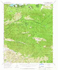
1954 Map of San Gorgonio Mountain
USGS Topo · Published 1966About this map
San Bernardino National Forest encompasses most of this landscape, where the southern California wilderness meets growing mid-century recreation and infrastructure. The map reveals a high-altitude network of youth camps and private resorts, including the Pasadena YMCA Camp, Camp Barton, and the Weesha Club, reflecting the area's development as a seasonal retreat. Near the northern edge, the community of Big Bear Lake sits alongside Metcalf Bay and Boulder Bay, while the peaks of San Bernardino Mountain and San Gorgonio Mountain anchor the high ridges to the south.
Find a feature on this map
116 named features on this map. Tap any name to fly to it.
Don’t see what you’re looking for? This feature index may not catch every label — zoom into the map to look around manually.
Map Details
Editions of this 1954 San Gorgonio Mountain Map
5 editions found

Other maps of this area

1899 · Redlands
USGS Topo · 1:62,500

1901 · Southern California Sheet No. 1
USGS Topo · 1:250,000

1901 · San Jacinto
USGS Topo · 1:125,000

1901 · Redlands
USGS Topo · 1:62,500

1901 · Elsinore
USGS Topo · 1:125,000

1902 · Deep Creek
USGS Topo · 1:62,500

1902 · San Gorgonio
USGS Topo · 1:125,000

1904 · Southern California Sheet No. 1
USGS Topo · 1:250,000

1940 · Palm Springs
USGS Topo · 1:62,500

1942 · Banning
USGS Topo · 1:62,500