1970 Map of San Gorgonio Mtn
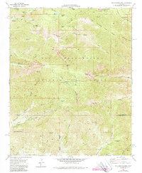
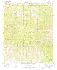
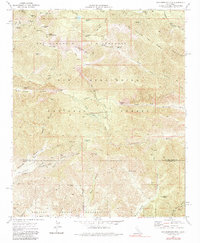
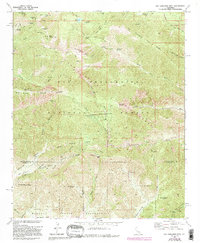
USGS Topo · Published 1988About this map
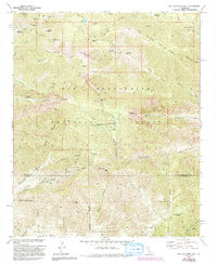
San Gorgonio Wilderness and its high-elevation terrain dominate this landscape, which was updated in 1988 to reflect contemporary features such as the Radio Facility and Diversion Dam. The map captures the rugged interior of the San Bernardino National Forest, where steep drainages like Mill Creek Canyon and Sawmill Canyon converge. Local history and resource extraction are marked by the Mill Creek Mine (Quarry) and the Penstock Powerhouse near Big Oaks Flat.
Find a feature on this map
59 named features on this map. Tap any name to fly to it.
Don’t see what you’re looking for? This feature index may not catch every label — zoom into the map to look around manually.
Map Details
Editions of this 1970 San Gorgonio Mtn Map
5 editions found
Other maps of this area

1901 · Southern California Sheet No. 1
USGS Topo · 1:250,000

1901 · San Jacinto
USGS Topo · 1:125,000

1902 · San Gorgonio
USGS Topo · 1:125,000

1904 · Southern California Sheet No. 1
USGS Topo · 1:250,000

1940 · Palm Springs
USGS Topo · 1:62,500

1942 · Banning
USGS Topo · 1:62,500
1943 · Banning
USGS Topo · 1:62,500
1944 · Palm Springs
USGS Topo · 1:62,500

1947 · Santa Ana
USGS Topo · 1:250,000

1949 · Santa Ana
USGS Topo · 1:250,000