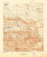
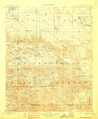
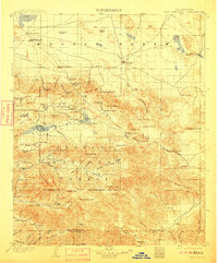
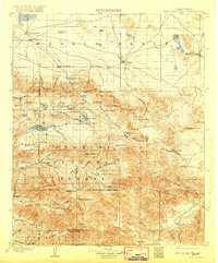
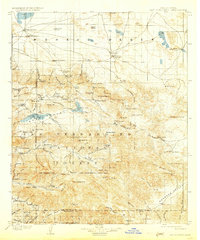
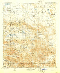
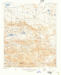
1902 Map of San Gorgonio
USGS Topo · Published 1944About this map
San Gorgonio Mt. dominates the high alpine landscape of this turn-of-the-century survey, standing as a pivotal landmark between the arid Mohave Desert and the river valleys to the south. The mapping reveals a transitional economy where high-altitude mining at the Rose Mine and Gold Mt. coincided with early mountain resort life near Bear Lake and Pine Lake. Settlement is sparse and largely vocational, defined by remote outposts such as Doble, Smarts Ranch, and the Lakeview Mill.
Find a feature on this map
111 named features on this map. Tap any name to fly to it.
Don’t see what you’re looking for? This feature index may not catch every label — zoom into the map to look around manually.
Map Details
Editions of this 1902 San Gorgonio Map
8 editions found
Other maps of this area

1899 · Redlands
USGS Topo · 1:62,500

1901 · Southern California Sheet No. 1
USGS Topo · 1:250,000

1901 · San Jacinto
USGS Topo · 1:125,000

1901 · Redlands
USGS Topo · 1:62,500

1901 · Elsinore
USGS Topo · 1:125,000

1902 · Deep Creek
USGS Topo · 1:62,500

1902 · San Gorgonio
USGS Topo · 1:125,000

1904 · Southern California Sheet No. 1
USGS Topo · 1:250,000

1932 · Barstow
USGS Topo · 1:125,000

1934 · Barstow
USGS Topo · 1:125,000