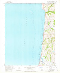
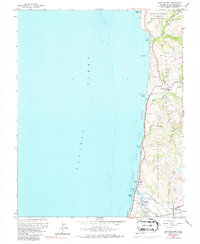
1961 Map of San Gregorio
USGS Topo · Published 1965About this map
San Mateo Coast State Beaches define the shoreline of this coastal survey, where the rugged cliffs of the Santa Cruz Mountains meet the Pacific Ocean. This early 1960s topographic study reveals the deep agricultural and ranching roots of the region through the persistence of old land grants, such as the San Gregorio (Rodriguez) Grant Boundary and the San Antonio or Pescadero Grant Boundary. These boundaries reflect the historical Spanish and Mexican era holdings that influenced the placement of early roads like Stage Road. To the south, the settlement of Pescadero serves as a local hub near the confluence of Pescadero Creek and Butano Creek, while nearby St Anthony Cem and Mt Hope Cem provide valuable touchpoints for family historians. The landscape is characterized by steep canyons carved by Tunitas Creek and San Gregorio Creek, illustrating the coastal drainage patterns before the expansion of modern development.
Find a feature on this map
27 named features on this map. Tap any name to fly to it.
Don’t see what you’re looking for? This feature index may not catch every label — zoom into the map to look around manually.
Map Details
Editions of this 1961 San Gregorio Map
5 editions found
Other maps of this area

1902 · Santa Cruz
USGS Topo · 1:125,000

1940 · Halfmoon Bay
USGS Topo · 1:62,500

1940 · Ano Nuevo
USGS Topo · 1:62,500

1941 · Ano Nuevo Pt.
USGS Topo · 1:62,500

1942 · Ano Nuevo
USGS Topo · 1:62,500

1943 · Halfmoon Bay
USGS Topo · 1:62,500

1947 · San Francisco
USGS Topo · 1:250,000

1948 · San Francisco
USGS Topo · 1:250,000

1948 · Ano Nuevo
USGS Topo · 1:62,500
1952 · Half Moon Bay
USGS Topo · 1:24,000