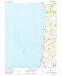
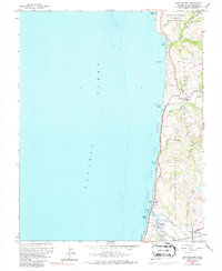
1961 Map of San Gregorio
USGS Topo · Published 1978About this map
The Pacific coastline of San Mateo County is defined here by the steep bluffs and creek outlets of the San Mateo Coast State Beaches. Following the early 1960s field checks, the landscape remains largely rural, dominated by historical land grant boundaries like San Gregorio (Rodriguez) and San Antonio or Pescadero. Small coastal settlements are concentrated at the junction of interior roads and the shoreline, notably around the village of San Gregorio and the southern cluster near Pescadero. The topography is marked by deep drainage gulches such as Long Gulch and Dairy Gulch, which slice through the coastal terraces toward the sea. Inland, the terrain rises toward Star Hill and Gordon Ridge, where Tunitas Creek Road winds through the hills. Genealogists will find local history preserved at the Mt Hope Cem and St Anthony Cem, both located near the winding course of Pescadero Creek.
Find a feature on this map
32 named features on this map. Tap any name to fly to it.
Don’t see what you’re looking for? This feature index may not catch every label — zoom into the map to look around manually.
Map Details
Editions of this 1961 San Gregorio Map
5 editions found
Other maps of this area

1902 · Santa Cruz
USGS Topo · 1:125,000

1940 · Halfmoon Bay
USGS Topo · 1:62,500

1940 · Ano Nuevo
USGS Topo · 1:62,500

1941 · Ano Nuevo Pt.
USGS Topo · 1:62,500

1942 · Ano Nuevo
USGS Topo · 1:62,500

1943 · Halfmoon Bay
USGS Topo · 1:62,500

1947 · San Francisco
USGS Topo · 1:250,000

1948 · San Francisco
USGS Topo · 1:250,000

1948 · Ano Nuevo
USGS Topo · 1:62,500
1952 · Half Moon Bay
USGS Topo · 1:24,000