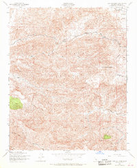
1943 Map of San Guillermo
USGS Topo · Published 1968About this map
San Guillermo Mountain stands as the central landmark in this 1943 survey, rising above a landscape of high-elevation canyons and seasonal drainages. During the early 1940s, this portion of the Los Padres National Forest was largely remote, characterized by deep watercourses like Alamo Creek and Piru Creek. Human presence is concentrated in the northern reaches, where the Plush Ranch and Three Falls Boy Scout Camp mark the edge of the Lockwood Valley. The survey, based on 1942 aerial photography, documents a network of unimproved roads and trails, including the distinctive route through Wagon Road Canyon. This era precedes significant modernization in the Ventura County backcountry, capturing a moment when family-owned ranching interests and youth recreation camps were the primary anchors in the rugged terrain between Dry Canyon and Pine Mtn.
Find a feature on this map
20 named features on this map. Tap any name to fly to it.
Don’t see what you’re looking for? This feature index may not catch every label — zoom into the map to look around manually.
Map Details
Editions of this 1943 San Guillermo Map
3 editions found
Other maps of this area

1903 · Mt. Pinos
USGS Topo · 1:125,000

1942 · Wheeler Springs
USGS Topo · 1:24,000

1943 · Topatopa Mountains
USGS Topo · 1:24,000

1943 · Apache Canyon
USGS Topo · 1:24,000

1943 · San Guillermo
USGS Topo · 1:24,000

1943 · Sawmill Mountain
USGS Topo · 1:24,000

1943 · Cuddy Valley
USGS Topo · 1:24,000

1943 · Lockwood Valley
USGS Topo · 1:24,000

1943 · Lion Canyon
USGS Topo · 1:24,000

1943 · Reyes Peak
USGS Topo · 1:24,000