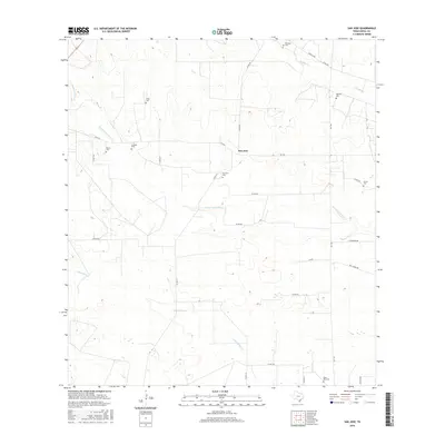
2016 Map of San Jose
USGS Topo · Published 2016About this map
San Jose and the surrounding brush country of Duval County are defined by a network of seasonal watercourses and deeply rooted family legacies. The landscape is etched with the paths of Santa Gertrudis Cr, Jaboncillos Cr, and Piedras Pintas Cr, which drain the low-lying terrain. This area is notable for its high concentration of family-named cemeteries, which serve as vital markers for genealogical research in this part of South Texas. These include Casas Cem, Bazan Cem, La Moda Cem, and Ramirez Cem, among others, each indicating historical ranching settlements and local community centers. Transport is facilitated by farm-to-market roads like FM 2295 and FM 1329, which connect these small hubs to the broader region. The proximity of San Jose Cem to the namesake settlement and the southern Santo Niño Cem further underscores the enduring local heritage preserved on this map.
Find a feature on this map
32 named features on this map. Tap any name to fly to it.
Don’t see what you’re looking for? This feature index may not catch every label — zoom into the map to look around manually.
Map Details
Editions of this 2016 San Jose Map
This is the sole edition of this map. No revisions or reprints were ever made.
Other maps of this area

1917 · Ben Bolt
USGS Topo · 1:62,500

1921 · Falfurrias
USGS Topo · 1:125,000

1956 · Benavides
USGS Topo · 1:62,500

1956 · Laredo
USGS Topo · 1:250,000

1963 · Ben Bolt NW
USGS Topo · 1:24,000
1963 · Palito Blanco
USGS Topo · 1:24,000
1963 · Seeligson Ranch
USGS Topo · 1:24,000

1968 · Concepcion
USGS Topo · 1:24,000

1968 · Benavides NW
USGS Topo · 1:24,000

1968 · San Jose
USGS Topo · 1:24,000