
1962 Map of San Jose
USGS Topo · Published 1962About this map
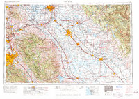
The San Joaquin Valley serves as the central corridor of this 1962 region, where a dense network of irrigation and transport infrastructure defines the landscape. Major agriculture and transit hubs like Modesto, Turlock, and Merced follow the path of the Southern Pacific RR and U S Highway 99. To the west, the Santa Clara Valley is anchored by San Jose and Santa Clara, showing the early footprint of suburban expansion before the tech era. The rugged Diablo Range separates these two valleys, featuring landmarks such as Mt Hamilton and Isabel Valley. In the east, the terrain rises toward the Sierra Nevada and the Stanislaus National Forest, where water management systems like the Hetch Hetchy Aqueduct and Don Pedro Reservoir emphasize the critical role of the Sierra watershed in supporting the growing Central Valley economy.
Find a feature on this map
162 named features on this map. Tap any name to fly to it.
Don’t see what you’re looking for? This feature index may not catch every label — zoom into the map to look around manually.
Map Details
Editions of this 1962 San Jose Map
4 editions found
Other maps of this area

1889 · Jackson
USGS Topo · 1:125,000

1889 · San Jose
USGS Topo · 1:62,500

1891 · Big Trees
USGS Topo · 1:125,000

1892 · Jackson
USGS Topo · 1:125,000

1893 · Sonora
USGS Topo · 1:125,000

1894 · Big Trees
USGS Topo · 1:125,000

1894 · Lodi
USGS Topo · 1:125,000

1896 · Dardanelles
USGS Topo · 1:125,000

1896 · Sonora
USGS Topo · 1:125,000

1896 · Carquinez Strait
USGS Topo · 1:62,500