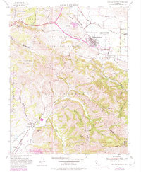
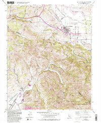
1955 Map of San Juan Bautista
USGS Topo · Published 1980About this map
Mission San Juan Bautista and the adjacent Hist Monuments anchor this 1955 survey of the San Andreas Fault zone and the San Benito Valley. The town of San Juan Bautista sits at the foot of the Gabilan Range, where the topography transitions from the alluvial plains of the Tract of Land Near San Juan Bautista to the rising elevations of Cherry Tree Ridge. The map illustrates a landscape shaped by both Spanish land grants and the complex geology of the rift zone, featuring numerous family-named roads and rural infrastructure like the Lagunita Sch and Olympia Sch. To the south, the terrain climbs toward Fremont Peak State Park and Rocky Ridge, while the western edge is defined by the winding Crazy Horse Canyon and the Bolsa de las Escorpinas land grant.
Find a feature on this map
52 named features on this map. Tap any name to fly to it.
Don’t see what you’re looking for? This feature index may not catch every label — zoom into the map to look around manually.
Map Details
Editions of this 1955 San Juan Bautista Map
5 editions found
Other maps of this area

1910 · Salinas
USGS Topo · 1:31,680

1912 · Salinas
USGS Topo · 1:62,500

1915 · San Juan Bautista
USGS Topo · 1:48,000

1917 · San Juan Bautista
USGS Topo · 1:62,500

1919 · Hollister
USGS Topo · 1:48,000

1921 · Gonzales
USGS Topo · 1:62,500

1921 · Hollister
USGS Topo · 1:62,500

1923 · Hollister
USGS Topo · 1:62,500

1939 · San Juan Bautista
USGS Topo · 1:62,500

1940 · San Juan Bautista
USGS Topo · 1:62,500