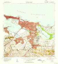
1949 Map of San Juan
USGS Topo · Published 1952About this map
San Juan Antiguo sits prominently on the islet between the Océano Atlántico and the Bahía de San Juan, anchored by the massive defenses of Fort Brook, La Fortaleza, and the Capitolio. This mid-century survey reveals a capital city in transition, where the historical core is linked via the Caño de San Antonio to the rapidly expanding urban landscape of Santurce and Hato Rey. The transport network of the era is clearly defined by the American RR and a dense web of major thoroughfares like Avenida Ponce de Leon. Cultural and institutional growth is evident in the sprawling grounds of the Universidad de Puerto Rico and the Colegio del Sagrado Corazón. Along the northern coast, the emerging tourism and aviation sectors are marked by Aeropuerto Isla Grande and the early footprint of Aeropuerto Internacional.
Find a feature on this map
130 named features on this map. Tap any name to fly to it.
Don’t see what you’re looking for? This feature index may not catch every label — zoom into the map to look around manually.
Map Details
Editions of this 1949 San Juan Map
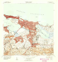
2 editions found
Other maps of this area

1940 · Carolina
USGS Topo · 1:30,000

1941 · Bayamon
USGS Topo · 1:30,000

1941 · San Juan
USGS Topo · 1:30,000

1941 · Carolina
USGS Topo · 1:30,000

1946 · Aguas Buenas
USGS Topo · 1:30,000

1946 · Naranjito
USGS Topo · 1:30,000

1946 · Gurabo
USGS Topo · 1:30,000

1947 · Carolina
USGS Topo · 1:30,000

1947 · Aguas Buenas NO
USGS Topo · 1:10,000

1947 · Bayamon
USGS Topo · 1:30,000