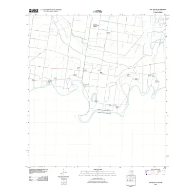
2010 Map of San Juan SE
USGS Topo · Published 2010About this map
The Rio Grande serves as the international boundary between the United States of America and Estados Unidos Mexicanos in this 2010 survey of Hidalgo County. The landscape is defined by the complex hydrology of the river basin, featuring numerous named "bancos"—distinctive oxbow features and land segments created by river meandering—such as Longoria Banco Number 39 and Monterrey Banco Number 89. This era shows a transition in land use, where established rural sites like Webber Cemetery and the Landa Gas Field coexist with residential developments like 9 North-East FM 493 Colonia. Extensive irrigation infrastructure, vital for South Texas agriculture, is represented by the Donna Main Canal and the Donna Pump, illustrating the engineering required to manage water from the river to the inland fields.
Find a feature on this map
40 named features on this map. Tap any name to fly to it.
Don’t see what you’re looking for? This feature index may not catch every label — zoom into the map to look around manually.
Map Details
Editions of this 2010 San Juan SE Map
This is the sole edition of this map. No revisions or reprints were ever made.
Other maps of this area

1914 · San Juan
USGS Topo · 1:48,000

1916 · San Juan
USGS Topo · 1:62,500

1949 · Mc Allen
USGS Topo · 1:250,000

1953 · Brownsville
USGS Topo · 1:250,000

1954 · McAllen
USGS Topo · 1:250,000

1956 · Mercedes
USGS Topo · 1:24,000
1956 · Progreso
USGS Topo · 1:24,000

1956 · Brownsville
USGS Topo · 1:250,000

1956 · Port Isabel
USGS Topo · 1:250,000

1957 · Mc Allen
USGS Topo · 1:250,000