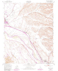
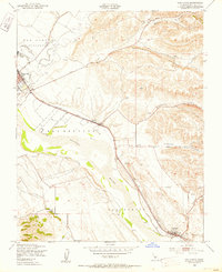
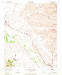
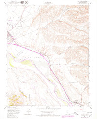
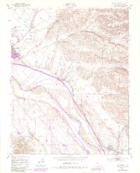
1949 Map of San Lucas
USGS Topo · Published 1949About this map
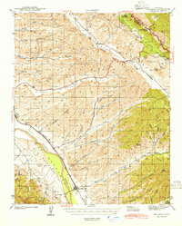
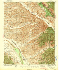
The Salinas River corridor defines the geography of this mid-century Monterey County study, following the Southern Pacific tracks through a valley flanked by deep canyons. Activity centers around King City in the northwest, where the Mesa Del Rey Airport and local industries sit adjacent to the river’s floodplain. To the southeast, the settlement of San Lucas marks a key stop along the rail line, surrounded by the wide-open spaces of the San Benito and San Bernabe land tracts.
Find a feature on this map
18 named features on this map. Tap any name to fly to it.
Don’t see what you’re looking for? This feature index may not catch every label — zoom into the map to look around manually.
Map Details
Editions of this 1949 San Lucas Map
5 editions found
Other maps of this area

1912 · San Ardo
USGS Topo · 1:31,680

1912 · Metz
USGS Topo · 1:31,680

1915 · Priest Valley
USGS Topo · 1:125,000

1919 · King City
USGS Topo · 1:62,500

1921 · Metz
USGS Topo · 1:62,500

1939 · King City
USGS Topo · 1:62,500

1940 · Metz
USGS Topo · 1:62,500
1941 · San Ardo
USGS Topo · 1:62,500
1943 · San Ardo
USGS Topo · 1:62,500

1943 · Hernandez Valley
USGS Topo · 1:62,500