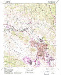
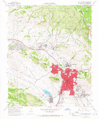
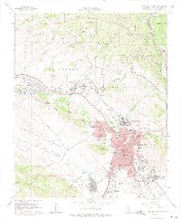
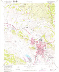
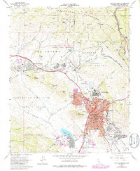
1965 Map of San Luis Obispo
USGS Topo · Published 1994About this map
San Luis Obispo is presented at a point of significant institutional and infrastructure growth, centered around the historic Old Mission and the sprawling campus of California Polytechnic State University. The mid-century landscape is defined by the contrast between the concentrated city grid and the surrounding peaks like Bishop Peak and Cerro Romualdo. To the northwest, the Camp San Luis Obispo National Guard Reservation and the Mens Colony indicate the area's role in state and military operations. Transportation and industry are evidenced by the Southern Pacific railroad line winding through the hills and active resource sites like the Gravel Pit and La Trinidad Mine. The southern reaches of the map show the developing residential areas near Laguna Lake and the Irish Hills, where newer features like the Shopping Center on Madonna Road appear in later revisions, documenting the city's outward expansion into the Los Osos Valley.
Find a feature on this map
65 named features on this map. Tap any name to fly to it.
Don’t see what you’re looking for? This feature index may not catch every label — zoom into the map to look around manually.
Map Details
Editions of this 1965 San Luis Obispo Map
5 editions found
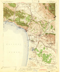
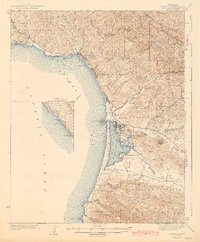
Other maps of this area

1897 · Port Harford
USGS Topo · 1:62,500

1897 · San Luis Obispo
USGS Topo · 1:62,500

1897 · Cayucos
USGS Topo · 1:62,500

1897 · Arroyo Grande
USGS Topo · 1:62,500

1900 · San Luis
USGS Topo · 1:125,000

1937 · Cayucos
USGS Topo · 1:62,500

1941 · Port San Luis
USGS Topo · 1:62,500

1942 · San Luis Obispo
USGS Topo · 1:62,500
1942 · Arroyo Grande
USGS Topo · 1:62,500
1943 · Cayucos
USGS Topo · 1:62,500