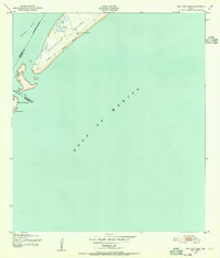
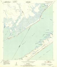
1943 Map of San Luis Pass
USGS Topo · Published 1955About this map
The southwestern tip of Galveston Island is the primary focus of this mid-century coastal survey, showing the dynamic landscape where West Bay meets the Gulf of Mexico. At the very edge of the island, the San Luis Coast Guard Sta. and its Cupola stand as a sentinel over the unpredictable waters of San Luis Pass. The map captures the shoreline during World War II, a period when this stretch of West Beach remained largely undeveloped, characterized by a single Telephone Line tracing the coast.
Find a feature on this map
14 named features on this map. Tap any name to fly to it.
Don’t see what you’re looking for? This feature index may not catch every label — zoom into the map to look around manually.
Map Details
Editions of this 1943 San Luis Pass Map
3 editions found
Other maps of this area

1929 · Karankawa Lake
USGS Topo · 1:24,000

1931 · Lake Como
USGS Topo · 1:24,000

1933 · Karankawa Lake
USGS Topo · 1:31,680

1933 · San Luis Pass
USGS Topo · 1:31,680
1933 · Lake Como
USGS Topo · 1:31,680

1943 · San Luis Pass
USGS Topo · 1:31,680
1943 · Lake Como
USGS Topo · 1:25,000
1943 · Carancahua Lake
USGS Topo · 1:24,000

1943 · Christmas Point
USGS Topo · 1:24,000

1943 · Chocolate Bay
USGS Topo · 1:24,000