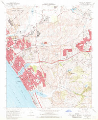
1968 Map of San Luis Rey
USGS Topo · Published 1969About this map
Mission San Luis Rey de Francia stands as a focal point in the northern reach of this coastal landscape, situated just south of the San Luis Rey River. By the late 1960s, the surrounding area shows significant suburban development and institutional growth, with the Army and Navy Academy and Miracosta College establishing a strong educational presence. The coastline is defined by the growing centers of Oceanside, South Oceanside, and Carlsbad, where the Atchison Topeka and Santa Fe railroad tracks parallel the shore near the Buena Vista Lagoon. To the north, the massive Camp Pendleton Marine Corps Base occupies the Ysidora Basin. Inland, the transition from urban plots to the hills is marked by an Open Pit Mine and several country clubs, illustrating the era's mix of resource extraction and leisure-based land use.
Find a feature on this map
102 named features on this map. Tap any name to fly to it.
Don’t see what you’re looking for? This feature index may not catch every label — zoom into the map to look around manually.
Map Details
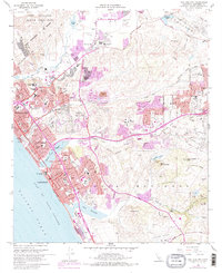
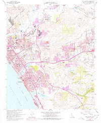
Editions of this 1968 San Luis Rey Map
3 editions found
Other maps of this area

1893 · Oceanside
USGS Topo · 1:62,500

1893 · Escondido
USGS Topo · 1:62,500

1898 · Oceanside
USGS Topo · 1:62,500

1901 · Escondido
USGS Topo · 1:62,500

1901 · Oceanside
USGS Topo · 1:62,500

1901 · San Luis Rey
USGS Topo · 1:125,000

1904 · Southern California Sheet No. 2
USGS Topo · 1:250,000

1941 · Margarita Peak
USGS Topo · 1:62,500

1942 · Margarita Peak
USGS Topo · 1:62,500

1942 · Temecula
USGS Topo · 1:62,500