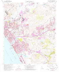
1968 Map of San Luis Rey
USGS Topo · Published 1978About this map
Mission San Luis Rey de Francia and its associated Mission San Luis Rey Academy anchor the northern reaches of this coastal landscape, situated along the San Luis Rey River. By the late 1960s and mid-1970s, the corridor between Oceanside, Carlsbad, and Vista shows significant urban expansion, indicated by purple revisions. The coastal geography is defined by the Buena Vista Lagoon and the sweeping shoreline of the Gulf of Santa Catalina, while the interior transitions into the highlands of Loma Alta Mtn and Cerro de la Calavera. Transportation networks are heavily developed, featuring the Atchison Topeka and Santa Fe railroad and the San Diego Freeway, illustrating the region's mid-century shift toward a modern suburban and military-adjacent economy near Camp Pendleton Marine Corps Base.
Find a feature on this map
70 named features on this map. Tap any name to fly to it.
Don’t see what you’re looking for? This feature index may not catch every label — zoom into the map to look around manually.
Map Details
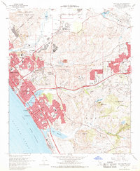
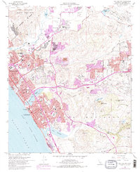
Editions of this 1968 San Luis Rey Map
3 editions found
Other maps of this area

1893 · Oceanside
USGS Topo · 1:62,500

1893 · Escondido
USGS Topo · 1:62,500

1898 · Oceanside
USGS Topo · 1:62,500

1901 · Escondido
USGS Topo · 1:62,500

1901 · Oceanside
USGS Topo · 1:62,500

1901 · San Luis Rey
USGS Topo · 1:125,000

1904 · Southern California Sheet No. 2
USGS Topo · 1:250,000

1941 · Margarita Peak
USGS Topo · 1:62,500

1942 · Margarita Peak
USGS Topo · 1:62,500

1942 · Temecula
USGS Topo · 1:62,500