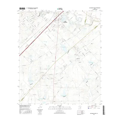
2016 Map of San Marcos South
USGS Topo · Published 2016About this map
The San Marcos River and Blanco River converge in this 2016 survey, a landscape defined by the suburban expansion of south San Marcos and the rural communities of Redwood and Zorn. The terrain transitions from the river bottoms to the elevation of Skyline Ridge, shaped by a series of regional water management projects including the John F Baugh Reservoir and numerous Soil Conservation Service sites. Genealogists will find several family and community burial grounds documented across the quadrangle, such as Pitts Cem, San Pedro Cem, and Crayton Cem. Small-scale aviation is represented by Alison Air Park, while the local hydrology is traced through Cottonwood Cr and York Cr, illustrating how modern infrastructure and flood control reservoirs have integrated with the historical settlement patterns of Hays and Guadalupe Counties.
Find a feature on this map
145 named features on this map. Tap any name to fly to it.
Don’t see what you’re looking for? This feature index may not catch every label — zoom into the map to look around manually.
Map Details
Editions of this 2016 San Marcos South Map
This is the sole edition of this map. No revisions or reprints were ever made.
Other maps of this area

1911 · San Marcos
USGS Topo · 1:125,000

1919 · San Marcos
USGS Topo · 1:125,000

1925 · New Braunfels No 1
USGS Topo · 1:48,000

1927 · New Braunfels
USGS Topo · 1:62,500

1929 · Hunter
USGS Topo · 1:62,500

1930 · Seguin
USGS Topo · 1:62,500

1953 · Seguin
USGS Topo · 1:250,000

1954 · San Antonio
USGS Topo · 1:250,000

1957 · San Antonio
USGS Topo · 1:250,000

1958 · Seguin
USGS Topo · 1:250,000