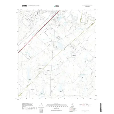
2019 Map of San Marcos South
USGS Topo · Published 2019About this map
The southern reaches of San Marcos and the surrounding Hill Country fringe appear in high detail during this decade of suburban expansion. The landscape is defined by the confluence of the San Marcos River and the Blanco River, which provide the primary drainage for the area. Moving south from the city center, the terrain shifts into the more open country of Redwood and the settlement of Zorn near the county line. This map is particularly valuable for genealogists, as it documents several smaller burial sites across the rural landscape, including Pitts Cem, Bading Cem, and Crayton Cem. Infrastructure like FM 2439 and the Interstate corridor contrast with the natural elevations of Skyline Ridge and the winding paths of Purgatory Cr and Willow Springs Cr. Water management features, such as the Soil Conservation Service Site 15 Reservoir and Webster Lake, reflect the region's managed hydrography.
Find a feature on this map
159 named features on this map. Tap any name to fly to it.
Don’t see what you’re looking for? This feature index may not catch every label — zoom into the map to look around manually.
Map Details
Editions of this 2019 San Marcos South Map
This is the sole edition of this map. No revisions or reprints were ever made.
Other maps of this area

1911 · San Marcos
USGS Topo · 1:125,000

1919 · San Marcos
USGS Topo · 1:125,000

1925 · New Braunfels No 1
USGS Topo · 1:48,000

1927 · New Braunfels
USGS Topo · 1:62,500

1929 · Hunter
USGS Topo · 1:62,500

1930 · Seguin
USGS Topo · 1:62,500

1953 · Seguin
USGS Topo · 1:250,000

1954 · San Antonio
USGS Topo · 1:250,000

1957 · San Antonio
USGS Topo · 1:250,000

1958 · Seguin
USGS Topo · 1:250,000