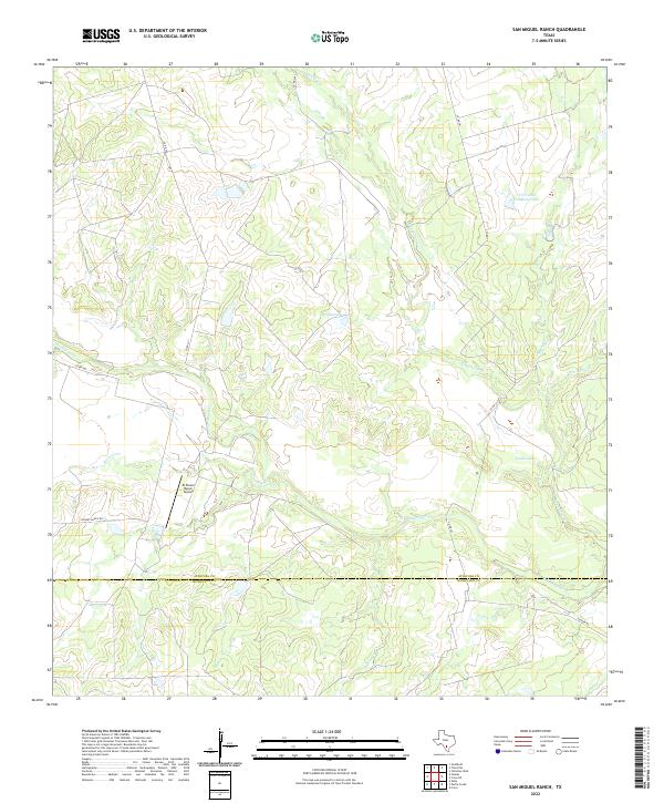
2022 Map of San Miguel Ranch
USGS Topo · Published 2022About this map
The south Texas ranching landscape along the border of Atascosa and McMullen counties is defined by a dense network of intermittent drainages and livestock-focused water improvements. The San Miguel Cr and its tributaries, including Lagunillas Cr and Raccoon Cr, carve through the brush country, creating a complex hydrologic pattern that dictated early settlement and land use. Small reservoirs and catchments are vital landmarks here, such as Hindes Lake, Erwin Lake, and T H Cattle Company Lake, serving the region's large cattle operations. Aviation infrastructure is represented by the El Tesoro Ranch Airport, located just north of Hinsley Ranch Rd. The map illustrates the sparse, high-acreage development characteristic of the region, where connectivity relies on local routes like Co RD 343 and Yeager Rd.
Find a feature on this map
20 named features on this map. Tap any name to fly to it.
Don’t see what you’re looking for? This feature index may not catch every label — zoom into the map to look around manually.
Map Details
Editions of this 2022 San Miguel Ranch Map
This is the sole edition of this map. No revisions or reprints were ever made.
Other maps of this area

1934 · Schattel
USGS Topo · 1:62,500

1953 · Crystal City
USGS Topo · 1:250,000

1955 · Crystal City
USGS Topo · 1:250,000

1956 · Jourdanton
USGS Topo · 1:62,500

1956 · Hindes
USGS Topo · 1:62,500

1956 · Franklin Settlement
USGS Topo · 1:62,500

1961 · Crystal City
USGS Topo · 1:250,000

1968 · Crystal City
USGS Topo · 1:250,000
1968 · Charlotte
USGS Topo · 1:24,000
1968 · Christine West
USGS Topo · 1:24,000