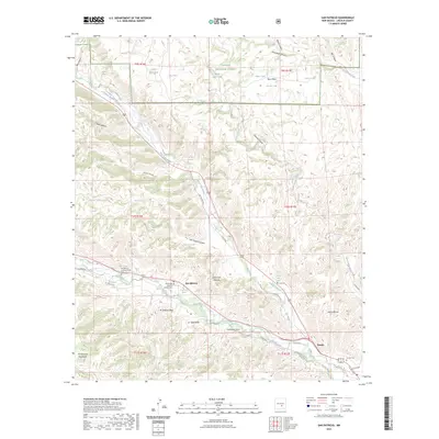
2023 Map of San Patricio
USGS Topo · Published 2023About this map
The confluence of the Rio Bonito and Rio Ruidoso forms the headwaters of the Rio Hondo in this area of Lincoln County. The settlements of San Patricio and Hondo follow the narrow fertile valleys between the high desert terrain of the Sacramento Mountains and the Sierra Blanca range. This geography concentrated historical settlement and irrigation along the river corridors, as seen in the placement of the San Patricio Catholic Church and the Saint Jude Catholic Mission.
Find a feature on this map
58 named features on this map. Tap any name to fly to it.
Don’t see what you’re looking for? This feature index may not catch every label — zoom into the map to look around manually.
Map Details
Editions of this 2023 San Patricio Map
This is the sole edition of this map. No revisions or reprints were ever made.
Other maps of this area

1935 · Capitan Mountains
USGS Topo · 1:48,000

1936 · Arabela
USGS Topo · 1:48,000

1940 · Capitan Mountains
USGS Topo · 1:62,500

1942 · Arabela
USGS Topo · 1:62,500

1955 · Roswell
USGS Topo · 1:250,000

1958 · Roswell
USGS Topo · 1:250,000

1961 · Lincoln
USGS Topo · 1:62,500

1961 · Tinnie
USGS Topo · 1:62,500

1962 · Roswell
USGS Topo · 1:250,000
1981 · Capitan Pass
USGS Topo · 1:24,000