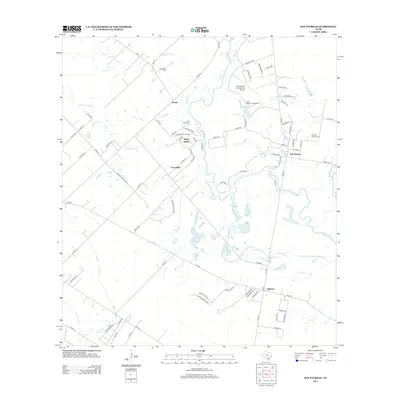
2013 Map of San Patricio
USGS Topo · Published 2013About this map
The James McGloin Homestead stands as a prominent historical landmark in this 2013 survey of the Texas coastal bend, situated near the winding course of the Nueces River. This region preserves its Irish colonial heritage through the layout of San Patricio and features like the Old San Patricio Cem, reflecting the early 19th-century settlement of the area. The map illustrates a rural landscape transitioning between historical ranching grounds and modern utility, with the site of Fort Lipantitlan marking a significant point of military history near Sandy Hollow. Smaller communities such as Bluntzer, Knolle, and Escondidas are dispersed across a terrain defined by numerous seasonal creeks like Quinta Cr and Javelin Cr, alongside local watering points like Round Lake Springs and Dismero Springs.
Find a feature on this map
88 named features on this map. Tap any name to fly to it.
Don’t see what you’re looking for? This feature index may not catch every label — zoom into the map to look around manually.
Map Details
Editions of this 2013 San Patricio Map
This is the sole edition of this map. No revisions or reprints were ever made.
Other maps of this area

1925 · Robstown
USGS Topo · 1:62,500

1925 · Mathis No. 3
USGS Topo · 1:48,000

1927 · Mathis
USGS Topo · 1:62,500

1950 · Corpus Christi
USGS Topo · 1:250,000

1953 · Beeville
USGS Topo · 1:250,000

1954 · Orange Grove
USGS Topo · 1:62,500

1954 · Robstown
USGS Topo · 1:62,500

1954 · Mathis
USGS Topo · 1:62,500

1954 · Sinton
USGS Topo · 1:62,500

1956 · Corpus Christi
USGS Topo · 1:250,000