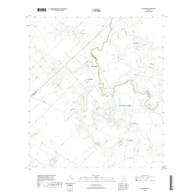
2019 Map of San Patricio
USGS Topo · Published 2019About this map
The Nueces River serves as the winding natural boundary between San Patricio and Nueces counties, carving a serpentine path through this South Texas landscape. Small rural settlements like San Patricio and Bluntzer anchor the region, connected by a network of farm roads and family-named routes such as McGloin St and Easley Ln. The area is marked by a deep historical footprint, evidenced by the Old San Patricio Cem and the proximity of Lipantitlan Park Rd, which alludes to the site of an old Mexican fort and earlier indigenous history. Hydrology defines the local character, with numerous springs and intermittent creeks like Sandy Hollow Cr and Cayamon Cr feeding into the river system. The settlement pattern of Sandy Hollow-Escondidas suggests modern rural community growth alongside established ranching lands, where labels like Old Ranch Cem point to generations of agricultural heritage.
Find a feature on this map
83 named features on this map. Tap any name to fly to it.
Don’t see what you’re looking for? This feature index may not catch every label — zoom into the map to look around manually.
Map Details
Editions of this 2019 San Patricio Map
This is the sole edition of this map. No revisions or reprints were ever made.
Other maps of this area

1925 · Robstown
USGS Topo · 1:62,500

1925 · Mathis No. 3
USGS Topo · 1:48,000

1927 · Mathis
USGS Topo · 1:62,500

1950 · Corpus Christi
USGS Topo · 1:250,000

1953 · Beeville
USGS Topo · 1:250,000

1954 · Orange Grove
USGS Topo · 1:62,500

1954 · Robstown
USGS Topo · 1:62,500

1954 · Mathis
USGS Topo · 1:62,500

1954 · Sinton
USGS Topo · 1:62,500

1956 · Corpus Christi
USGS Topo · 1:250,000