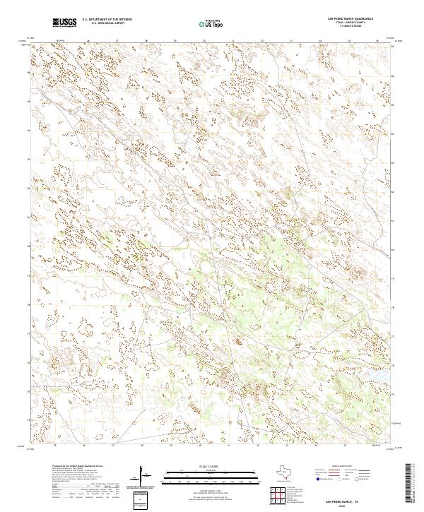
2022 Map of San Pedro Ranch
USGS Topo · Published 2022About this map
Dunes and coastal wetlands define this section of the South Texas landscape, where very little infrastructure breaks the natural topography of Kenedy County. The most prominent human markers are the remote transit corridors of Gulf Wind Rd and E Turcotte Rd, which cut through the eastern portion of the quadrangle. This area represents the expansive, private ranching lands characteristic of the region, where the terrain is shaped more by wind and seasonal water than by settlement. The intricate contour lines across the sheet illustrate a complex system of low rises and depressions, typical of the coastal prairie and sand sheet environments that dominate this part of the state.
Find a feature on this map
2 named features on this map. Tap any name to fly to it.
Don’t see what you’re looking for? This feature index may not catch every label — zoom into the map to look around manually.
Map Details
Editions of this 2022 San Pedro Ranch Map
This is the sole edition of this map. No revisions or reprints were ever made.
Other maps of this area

1923 · Armstrong
USGS Topo · 1:62,500

1923 · Saltillo Ranch
USGS Topo · 1:62,500

1928 · Sarita
USGS Topo · 1:125,000

1950 · Corpus Christi
USGS Topo · 1:250,000

1952 · Sarita 4 SE
USGS Topo · 1:24,000

1953 · Brownsville
USGS Topo · 1:250,000

1954 · La Parra Ranch SW
USGS Topo · 1:24,000

1954 · Sarita
USGS Topo · 1:62,500
1955 · La Parra Ranch
USGS Topo · 1:62,500

1956 · Corpus Christi
USGS Topo · 1:250,000