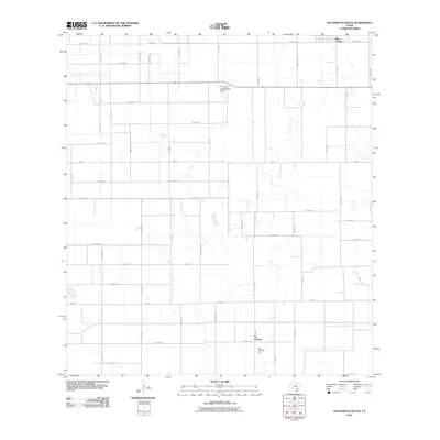
2010 Map of San Perlita South
USGS Topo · Published 2010About this map
Agricultural patterns and transport networks define this area of Willacy County, where the small community of San Perlita sits near the northern boundary. The landscape is dominated by a grid of farm-to-market roads and rural routes, reflecting the region's deep ties to cotton and produce cultivation. Near the southern edge, Los Coyotes serves as a localized hub for farming operations, anchored by the presence of the Los Coyotes Gin. Private aviation infrastructure is visible at the T R Funk Incorporated Airport, which facilitates aerial operations essential to large-scale ranching and farming. Key thoroughfares such as Fm 490 and Chappel Rd provide the primary framework for movement across this coastal prairie terrain, connecting scattered homesteads and industrial agricultural sites.
Find a feature on this map
51 named features on this map. Tap any name to fly to it.
Don’t see what you’re looking for? This feature index may not catch every label — zoom into the map to look around manually.
Map Details
Editions of this 2010 San Perlita South Map
This is the sole edition of this map. No revisions or reprints were ever made.
Other maps of this area

1921 · Tarida Ranch
USGS Topo · 1:62,500

1922 · La Sal Vieja
USGS Topo · 1:62,500

1929 · Santa Rosa
USGS Topo · 1:24,000

1932 · Combes
USGS Topo · 1:31,680

1933 · Santa Rosa
USGS Topo · 1:31,680

1933 · Paso Real
USGS Topo · 1:31,680

1953 · Brownsville
USGS Topo · 1:250,000

1956 · San Perlita South
USGS Topo · 1:24,000

1956 · San Perlita North
USGS Topo · 1:24,000

1956 · Santa Rosa
USGS Topo · 1:24,000