
1956 Map of Santa Rosa
USGS Topo · Published 1958About this map
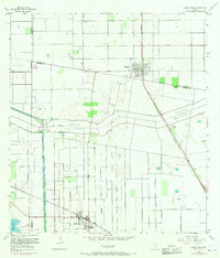
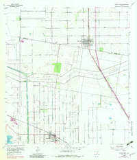
The agricultural landscape of the Rio Grande Valley is defined here by a sophisticated network of water management and rail transport during the mid-1950s. The North Floodway and its Pilot Channel cut a wide swath across the terrain, flanked by a series of levees and an Elevated Ditch system designed to control the seasonal flow of water. These engineering works supported the surrounding citrus groves and fields, anchored by the settlements of Santa Rosa and Sebastian. The rail economy is clearly visible where the Missouri Pacific and the Texas and New Orleans lines intersect the grid-like road system. For genealogists, the map preserves the locations of several community burial grounds, including Santa Rita Cem, Guadalupe Cem, and San Rafael Cem, alongside family-named thoroughfares such as Cantu Road and Rabb Road.
Find a feature on this map
29 named features on this map. Tap any name to fly to it.
Don’t see what you’re looking for? This feature index may not catch every label — zoom into the map to look around manually.
Map Details
Editions of this 1956 Santa Rosa Map
3 editions found
Other maps of this area

1929 · Harlingen
USGS Topo · 1:24,000

1929 · Santa Rosa
USGS Topo · 1:24,000

1929 · La Feria
USGS Topo · 1:24,000

1932 · Combes
USGS Topo · 1:31,680

1932 · Harlingen
USGS Topo · 1:31,680

1933 · Santa Rosa
USGS Topo · 1:31,680

1936 · La Feria
USGS Topo · 1:31,680

1953 · Brownsville
USGS Topo · 1:250,000

1956 · San Perlita South
USGS Topo · 1:24,000
1956 · Willamar SW
USGS Topo · 1:24,000
Featured Places
- Santa Rosa, TX
- Sebastian, TX
- S and C Colonia, TX
- Yznaga Number 1 Colonia, TX
- Tierra Bonita Number 2 Colonia, TX