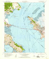
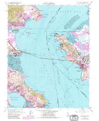
1959 Map of San Quentin
USGS Topo · Published 1960About this map
San Quentin State Prison and the newly completed Richmond - San Rafael Bridge dominate the central waters of the San Pablo Strait, connecting the Marin coastline to the industrial hubs of the East Bay. This survey reflects a significant era of maritime and military activity, with the Naval Fuel Supply Depot at Pt Molate and the Tiburon Naval Net Depot near Bluff Pt highlighting the region's strategic importance. Along the Tiburon Peninsula, residential growth is evident in the development of Hilarita and Belvedere, supported by local institutions like the Bel Aire School and Reed Sch.
Find a feature on this map
73 named features on this map. Tap any name to fly to it.
Don’t see what you’re looking for? This feature index may not catch every label — zoom into the map to look around manually.
Map Details
Editions of this 1959 San Quentin Map
5 editions found
Other maps of this area

1895 · San Francisco
USGS Topo · 1:62,500

1897 · Tamalpais
USGS Topo · 1:62,500

1899 · San Francisco
USGS Topo · 1:62,500

1902 · Napa
USGS Topo · 1:125,000

1914 · Petaluma
USGS Topo · 1:62,500

1915 · San Francisco
USGS Topo · 1:62,500

1916 · Mare Island
USGS Topo · 1:62,500

1941 · Tamalpais
USGS Topo · 1:62,500

1942 · Mare Island
USGS Topo · 1:62,500

1942 · Petaluma
USGS Topo · 1:62,500