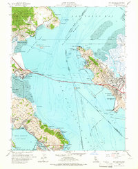
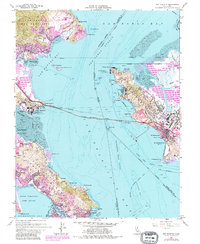
1959 Map of San Quentin
USGS Topo · Published 1965About this map
The Richmond-San Rafael Bridge spans the waters between Marin and Contra Costa counties, serving as a massive structural anchor for this late 1950s coastal survey. Along the Marin shoreline, the complex of San Quentin State Prison sits prominently at Pt San Quentin, while to the south, the Tiburon Peninsula shows a mix of residential growth in Belvedere and Tiburon alongside significant military installations like the Tiburon Naval Net Depot.
Find a feature on this map
72 named features on this map. Tap any name to fly to it.
Don’t see what you’re looking for? This feature index may not catch every label — zoom into the map to look around manually.
Map Details
Editions of this 1959 San Quentin Map
5 editions found
Other maps of this area

1895 · San Francisco
USGS Topo · 1:62,500

1897 · Tamalpais
USGS Topo · 1:62,500

1899 · San Francisco
USGS Topo · 1:62,500

1902 · Napa
USGS Topo · 1:125,000

1914 · Petaluma
USGS Topo · 1:62,500

1915 · San Francisco
USGS Topo · 1:62,500

1916 · Mare Island
USGS Topo · 1:62,500

1941 · Tamalpais
USGS Topo · 1:62,500

1942 · Mare Island
USGS Topo · 1:62,500

1942 · Petaluma
USGS Topo · 1:62,500