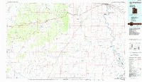
1985 Map of San Rafael Desert
USGS Topo · Published 1985About this map
San Rafael Swell and the surrounding desert landscape dominate this mid-1980s survey, illustrating a region defined by dramatic geologic formations and isolated mining operations. The map traces the winding course of the Green River and the San Rafael River, highlighting the intricate drainage patterns of Labyrinth Canyon and Three Canyon. Human presence is concentrated near the settlement of Green River and along the Denver and Rio Grande Western railroad, while the interior remains a domain of resource extraction and preservation. The presence of the Temple Mountain Mines, Copper Globe Mine, and Lucky Strike Mine speaks to the era's industrial activity. Meanwhile, the establishment of the Goblin Valley State Reserve protects the unique erosion features of the San Rafael Reef, contrasting the utility of the Green River Airport with the wilderness of Hondu Country and Keesle Country.
Find a feature on this map
154 named features on this map. Tap any name to fly to it.
Don’t see what you’re looking for? This feature index may not catch every label — zoom into the map to look around manually.
Map Details
Editions of this 1985 San Rafael Desert Map
This is the sole edition of this map. No revisions or reprints were ever made.
Other maps of this area

1885 · San Rafael
USGS Topo · 1:250,000

1885 · Manti
USGS Topo · 1:250,000

1885 · East Tavaputs
USGS Topo · 1:250,000

1885 · La Sal
USGS Topo · 1:250,000

1885 · Fish Lake
USGS Topo · 1:250,000

1886 · Price River
USGS Topo · 1:250,000

1895 · Manti
USGS Topo · 1:250,000

1896 · Price River
USGS Topo · 1:250,000

1896 · Fish Lake
USGS Topo · 1:250,000

1923 · Castle Dale
USGS Topo · 1:62,500