
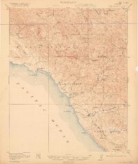
1919 Map of San Simeon
USGS Topo · Published 1919About this map
San Simeon and the Hearst Ranch anchor this rugged coastal landscape during the late First World War era. The rugged terrain of the Santa Lucia Range and the Piedra Blanca peaks meets the Pacific Ocean at San Simeon Bay, where coastal life centered around early landings and cattle ranching. Inland, the map reveals a shift from maritime activities to upland mining, with several sites including the Ocean View Mine and Keystone Mine marked as abandoned, signaling a change in the local economy.
Find a feature on this map
74 named features on this map. Tap any name to fly to it.
Don’t see what you’re looking for? This feature index may not catch every label — zoom into the map to look around manually.
Map Details
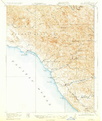
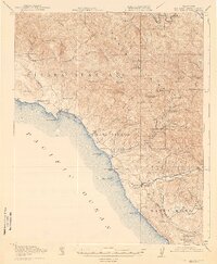
Editions of this 1919 San Simeon Map
4 editions found
Other maps of this area

1897 · Cayucos
USGS Topo · 1:62,500

1900 · San Luis
USGS Topo · 1:125,000

1919 · Bryson
USGS Topo · 1:62,500

1919 · Bradley
USGS Topo · 1:62,500

1919 · Adelaida
USGS Topo · 1:62,500

1919 · Piedras Blancas
USGS Topo · 1:62,500

1921 · Cape San Martin
USGS Topo · 1:62,500
1927 · Piedras Blancas
USGS Topo · 1:62,500

1932 · Adelaida
USGS Topo · 1:62,500

1937 · Cayucos
USGS Topo · 1:62,500