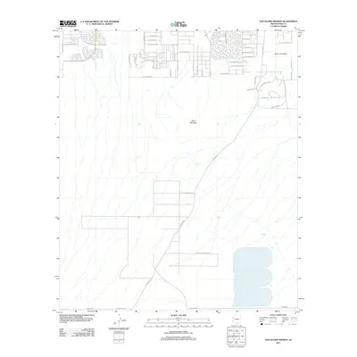
2011 Map of San Xavier Mission
USGS Topo · Published 2011About this map
Tohono O'odham Nation lands define much of this 2011 survey south of Tucson, revealing the transitional zone between expanding suburban development and tribal territories. The landscape is anchored by the prominent Black Mountain and the broad Santa Cruz Valley to the east. Modern road networks, such as W Los Reales Rd and S Mission Rd, illustrate the increasing residential density in the northern sections, while the southern reaches remain relatively open. The map provides a clear view of local infrastructure just before significant changes in the Pima County region, showing the alignment of thoroughfares like Pima Mine Rd and many smaller tribal roads including Sudagi Wog and W Koli Ki Wog.
Find a feature on this map
35 named features on this map. Tap any name to fly to it.
Don’t see what you’re looking for? This feature index may not catch every label — zoom into the map to look around manually.
Map Details
Editions of this 2011 San Xavier Mission Map
This is the sole edition of this map. No revisions or reprints were ever made.
Other maps of this area

1904 · Patagonia
USGS Topo · 1:125,000

1904 · Tucson
USGS Topo · 1:125,000

1905 · Patagonia
USGS Topo · 1:125,000

1905 · Tucson
USGS Topo · 1:125,000

1920 · Arivaca
USGS Topo · 1:125,000

1925 · Samaniego Peak
USGS Topo · 1:62,500

1925 · San Xavier
USGS Topo · 1:62,500

1926 · Helvetia
USGS Topo · 1:62,500

1934 · Tucson Mountains
USGS Topo · 1:125,000

1939 · Twin Buttes
USGS Topo · 1:62,500