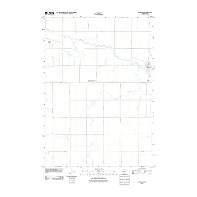
2010 Map of Sanborn
USGS Topo · Published 2010About this map
The Cottonwood River meanders across this Redwood County landscape, anchoring the village of Sanborn, which serves as the primary hub of activity. The map reveals a structured rural environment defined by a grid of agricultural roads, including County Hwy-15 and County Hwy-11, that connect outlying homesteads to the town center. Genealogists and local historians can locate several significant burial grounds, notably the Germantown Evangelical United Methodist Cemetery and the Lamberton Cemetery on the western edge. Within the town limits, the Sanborn Post Office remains a central landmark. The drainage system is heavily influenced by seasonal waterways like Dutch Charley Creek and Dry Creek, illustrating the natural topography that shaped early settlement patterns in this part of Minnesota.
Find a feature on this map
36 named features on this map. Tap any name to fly to it.
Don’t see what you’re looking for? This feature index may not catch every label — zoom into the map to look around manually.
Map Details
Editions of this 2010 Sanborn Map
This is the sole edition of this map. No revisions or reprints were ever made.
Other maps of this area

1953 · New Ulm
USGS Topo · 1:250,000

1957 · New Ulm
USGS Topo · 1:250,000

1958 · New Ulm
USGS Topo · 1:250,000

1967 · New Ulm
USGS Topo · 1:250,000

1967 · Wanda
USGS Topo · 1:24,000

1967 · Sanborn
USGS Topo · 1:24,000

1967 · Wabasso SE
USGS Topo · 1:24,000

1967 · Clements SE
USGS Topo · 1:24,000

1967 · Sanborn SE
USGS Topo · 1:24,000

1967 · Sanborn NE
USGS Topo · 1:24,000