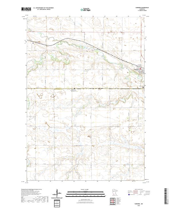
2022 Map of Sanborn
USGS Topo · Published 2022About this map
Sanborn sits at the eastern edge of this agricultural landscape where the Cottonwood River carves a winding path through the prairie. The river’s valley is a central topographic feature, joined by tributaries such as Dutch Charley Cr and Highwater Cr that drain the surrounding fields. The map documents a strictly organized grid of rural roads, including Lamberton Rd and Co HWY 12, which define the section lines across the Redwood Co and Cottonwood Co border. For those researching local heritage, the map identifies specific community landmarks like the Germantown Evangelical United Methodist Cem and the Sanborn Cem near the town center. The drainage patterns of Dry Cr in the south further illustrate the hydrological layout of this fertile farming region in southwest Minnesota.
Find a feature on this map
48 named features on this map. Tap any name to fly to it.
Don’t see what you’re looking for? This feature index may not catch every label — zoom into the map to look around manually.
Map Details
Editions of this 2022 Sanborn Map
This is the sole edition of this map. No revisions or reprints were ever made.
Other maps of this area

1953 · New Ulm
USGS Topo · 1:250,000

1957 · New Ulm
USGS Topo · 1:250,000

1958 · New Ulm
USGS Topo · 1:250,000

1967 · New Ulm
USGS Topo · 1:250,000

1967 · Wanda
USGS Topo · 1:24,000

1967 · Sanborn
USGS Topo · 1:24,000

1967 · Wabasso SE
USGS Topo · 1:24,000

1967 · Clements SE
USGS Topo · 1:24,000

1967 · Sanborn SE
USGS Topo · 1:24,000

1967 · Sanborn NE
USGS Topo · 1:24,000