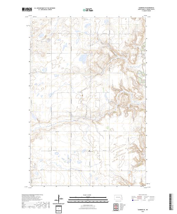
2024 Map of Sanborn SE
USGS Topo · Published 2024About this map
The Sheyenne River cuts through the eastern edge of this Barnes County landscape, defining the most varied topography in an otherwise orderly grid of section lines and prairie. This modern survey illustrates the persistent agricultural layout of the region, where gravel roads like 44th St SE and 114th Ave SE follow the original Public Land Survey System boundaries. A significant cultural landmark is the Ringsaker Cem, located in township t138n r59w, which serves as a primary point of interest for genealogists tracing Norwegian-American roots in the area. While the landscape is dominated by large-scale farming and glacial wetlands, the presence of the North Country National Scenic Trl winding through the river valley highlights the modern intersection of recreational land use and traditional rural heritage.
Find a feature on this map
22 named features on this map. Tap any name to fly to it.
Don’t see what you’re looking for? This feature index may not catch every label — zoom into the map to look around manually.
Map Details
Editions of this 2024 Sanborn SE Map
This is the sole edition of this map. No revisions or reprints were ever made.
Other maps of this area

1897 · Tower
USGS Topo · 1:125,000

1897 · Eckelson
USGS Topo · 1:125,000

1953 · Jamestown
USGS Topo · 1:250,000

1953 · Fargo
USGS Topo · 1:250,000

1956 · Fargo
USGS Topo · 1:250,000

1956 · Jamestown
USGS Topo · 1:250,000

1961 · Valley City East
USGS Topo · 1:24,000

1961 · Valley City West
USGS Topo · 1:24,000

1967 · Fingal SW
USGS Topo · 1:24,000
1967 · Kathryn
USGS Topo · 1:24,000